

Geography of India

Area: 3,287,263 sq km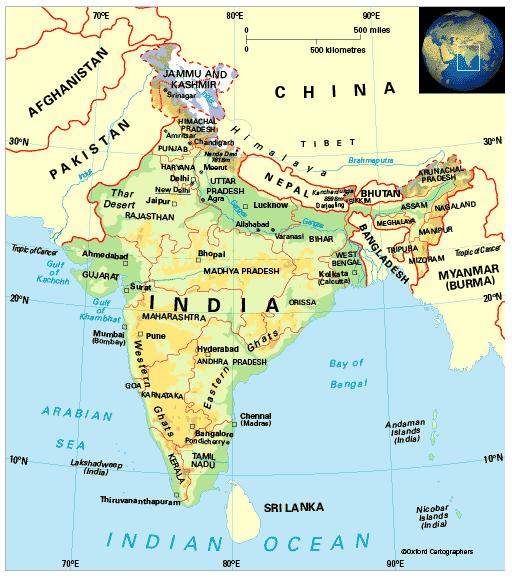
Coastline: 7,520km
Capital: New Delhi
The Republic of India, which lies across the Tropic of Cancer, comprises most of the Indian subcontinent. It also includes the Andaman and Nicobar Islands in the Bay of Bengal and the Lakshadweep Islands in the Arabian Sea. Its neighbours are Pakistan, Afghanistan and China to the north, then Nepal, Bhutan, Bangladesh and Myanmar (formerly Burma). In the south, the Palk Strait separates it from Sri Lanka.
India is a federal republic with 29 states (including the Delhi National Capital Territory), and six union territories.