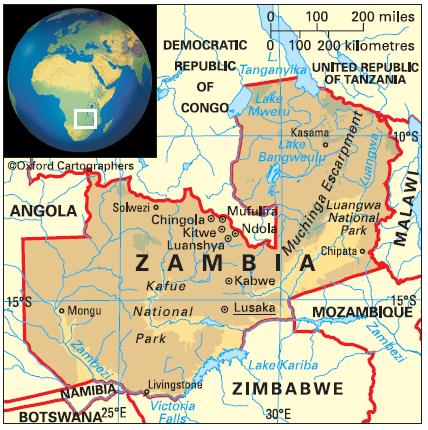
Geography of Zambia
Area: 752,614 sq km
Coastline: none
Capital: Lusaka
Zambia is a landlocked, fertile and mineral-rich country on the Southern African plateau. It is bordered by: (clockwise from the north) the United Republic of Tanzania, Malawi, Mozambique, Zimbabwe, Botswana, Namibia (via the Caprivi Strip), Angola and the Democratic Republic of Congo.
The country comprises ten provinces (from south to north): Southern, Western, Lusaka, Central, Eastern, North-Western, Copperbelt, Northern, Muchinga (whose creation was announced in October 2011) and Luapula.


