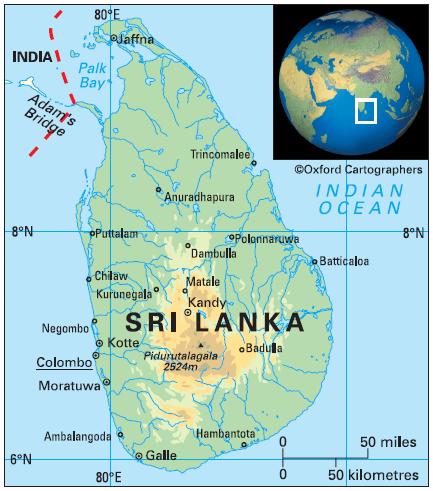
Geography of Sri Lanka
Area: 65,610 sq km
Coastline: 1,340km
Capital: Colombo
The Democratic Socialist Republic of Sri Lanka (formerly Ceylon) is an island in the Indian Ocean, separated from south-east India (Tamil Nadu state) by the Palk Strait. It is almost linked to the Indian mainland by Adam’s Bridge, an atoll barrier, mostly submerged, lying between the offshore island of Mannar and India itself.
The country comprises nine provinces (from south to north): Southern (provincial capital Galle), Sabaragamuwa (Ratnapura), Western (Colombo), Uva (Badulla), Eastern (Trincomalee), Central (Kandy), North-Western (Kurunegala), North-Central (Anuradhapura) and Northern (Jaffna).


