

Geography of Canada

Area: 9,976,000 sq km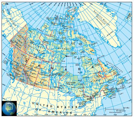
Coastline: 202,100km
Capital: Ottawa
The second largest country in the world, Canada comprises the northern half of the North American continent, bordering with the USA to the south and north-west (Alaska). It is bounded by three oceans: the Pacific to the west; the Arctic to the north; and the Atlantic to the east. Indented shores and numerous islands (some very large) give it the longest coastline of any country at 202,100km. Cape Columbia on Ellesmere Island is 768km from the North Pole.
Canada is a federation of ten provinces and three territories. The provinces (and provincial capitals) are: Alberta (Edmonton), British Columbia (Victoria), Manitoba (Winnipeg), New Brunswick (Fredericton), Newfoundland and Labrador (St John’s), Nova Scotia (Halifax), Ontario (Toronto), Prince Edward Island (Charlottetown), Québec (Québec), Saskatchewan (Regina); and the territories (and capitals): Northwest Territories (Yellowknife), Nunavut (Iqaluit) and Yukon (Whitehorse). Nunavut was formed in April 1999 – from the eastern and central parts of the Northwest Territories – as a semi-autonomous region for the Inuit people.