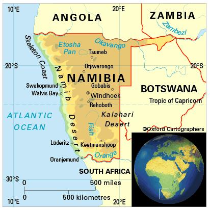
Geography of Namibia
Area: 824,269 sq km
Coastline: 1,570km
Capital: Windhoek
Namibia in south-west Africa is one of the driest and most sparsely populated countries on Earth. It is bounded by the South Atlantic Ocean on the west,Angolato the north,Botswanato the east andSouth Africato the south. The Caprivi Strip, a narrow extension of land in the extreme north-east, connects it toZambia.
Namibia comprises 13 regions (from south to north): Karas, Hardap, Khomas, Erongo, Omaheke, Otjozondjupa, Kunene, Oshikoto, Okavango, Omusati, Oshana, Caprivi and Ohangwena.


