

Geography of Brunei Darussalam

Area: 5,765 sq km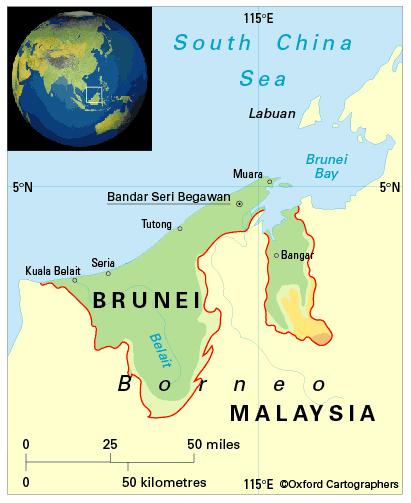
Coastline: 161km
Capital: Bandar Seri Begawan
Brunei Darussalam (Brunei – ‘Abode of Peace’) is a small state in South-East Asia on the north-west coast of the island of Borneo, in the Indonesian Archipelago. Its 161km coastline faces the South China Sea. On the land side, it is enclosed by the Malaysian state of Sarawak, which divides it in two.
The districts of Brunei–Muara, Tutong and Belait make up the larger, western part of the country; Temburong district the east.