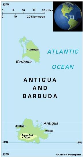
Geography of Antigua and Barbuda
Area: 443 sq km 
Coastline: 153km
Capital: St John’s
Geography: Antigua and Barbuda, at the north of the Leeward Islands in the Eastern Caribbean, is composed of three islands: Antigua (280 sq km), Barbuda (161 sq km; 40km north of Antigua) and Redonda (1.6 sq km; 40km south-west of Antigua).
Environment: The most significant environmental issue is limited natural freshwater resources which is aggravated by clearing of trees to increase crop production, causing rainfall to run off quickly.
Little remains of Antigua’s natural vegetation, as the island was formerly cleared for sugar planting. Unlike other islands in the Leeward group, it has little forest; mangoes, guavas, coconuts and bananas grow in the south-west (forest covers 20% of the land area). Barbuda is well wooded in the north-east, providing a haven for wildlife.
Transport: There is a good road network of about 1,170km, 33% paved. St John’s deep water harbour is a regional centre for cargo and passengers and the country’s main port. VC Bird International Airport is 8km north-east of St John’s; and an airstrip at Codrington, Barbuda, is suitable for light aircraft.
Communications: Country code 1 268. Mobile phone coverage is good.
There are 439 main telephone lines and 1,577 mobile phone subscriptions per 1,000 people (2008).


