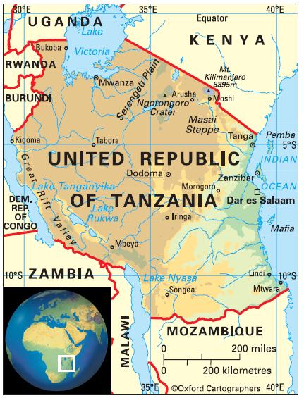
Geography of United Republic of Tanzania
Area: 945,090 sq km
Coastline: 1,420km
Capital: Dodoma
The United Republic of Tanzania borders the Indian Ocean to the east, and has land borders with eight countries: (anti-clockwise from the north) Kenya, Uganda, Rwanda, Burundi, the Democratic Republic of Congo (across Lake Tanganyika), Zambia, Malawi and Mozambique. The country includes Zanzibar (consisting of the main island Unguja, plus Pemba and other smaller islands).


