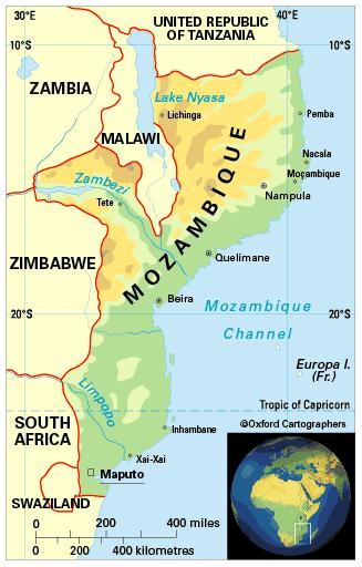
Geography of Mozambique
Area: 799,380 sq km
Coastline: 2,470km
Capital: Maputo
Mozambique is in south-east Africa and borders (anti-clockwise, from north) the United Republic of Tanzania, Malawi, Zambia,Zimbabwe, South Africa, Swaziland and the Indian Ocean.
The country is divided into eleven provinces (from south to north):Maputo,Maputocity,Gaza, Inhambane, Manica, Sofala, Zambézia, Tete, Nampula, Niassa and Cabo Delgado.


